Showing posts with label Geography fact. Show all posts

Tuesday, May 9, 2023

White gold found again in India


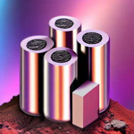
In a gap of 4 months, 'white gold' was found again on the soil of the country. After Jammu and Kashmir, this time lithium was also found in Rajasthan. Which is undoubtedly considered important for India. A lithium mine has been discovered in Rajasthan's Degana area. This is what the government officials of that state said.

However, it is not yet known how much lithium has been discovered in Rajasthan. According to Geological Survey of India, more lithium was found in Rajasthan than what was found in Jammu and Kashmir last February.

Government officials claim that the amount of lithium found in Rajasthan can meet more than 80 percent of the country's demand.

However, even if lithium deposits are found in Rajasthan, India, mining them is not very easy. Because lithium mining requires a lot of water, and Rajasthan has a water shortage, so it is difficult to say how successful this extraction process will be.

Friday, April 28, 2023

The only river in the world that has a rainbow in its waters

 The only colorful river in the world

There are many rivers in the world whose water is clear. But for clarity, a river in the world looks colorful. And this is probably the only colorful river in the world. Red, blue, yellow, purple, orange - all colors are present in the water of this river. Although it has a traditional name, some people call this river 'River of Colors' for its colorful water, while others call it 'Liquid Rainbow'. To many, this river is the 'Melted Rainbow'. July to November is the best time to see the colorful waters of Canyon Crystals.

The real secret behind the color of this river is a type of aquatic plant in the river. The water of the river is so clear that the reflection of various colors of the plants can be seen in the river current. It shining even more in the sunlight. The submerged plant name is Macarenia clavigera. This family of trees clings to thousands of years old quartzite rock under the riverbed. If there is too much water in the river or if the water level is too low, the colorful game can no longer be seen. With less water, the tree dries up and becomes brown colour. If there is too much water, you cannot see the bottom of the river. As a result, the rainbow also disappeared in the river. The Serrania de la Macarena region of Colombia is also named after this plant.

To see this amazing game of color, you have to reach the city of Villavencio in central Colombia. From there take another flight to La Macarena. A 'guide' is available from there to demonstrate the 'Liquid Rainbow' spin. Serrania de la Macarena is a very quiet mountain town. Not many people live there. A few local tourism agencies take tourists around the river. In some places there is an opportunity to swim in colored water.

The administration of Colombia has also made arrangements to preserve this wonderful beauty of nature. Tourist movement in the area has been restricted to ensure that there is no damage to the trees in or under the river water.

Monday, March 6, 2023

The highest places in the world are


The highest everything in the world


Dam: -


In terms of location - 'The Grands' dam in
Switzerland.


In terms of height - Roguskaya Dam on the
Vakhsh River in Tajikistan.


Rail Bridge: - Arch rail bridge located between Bakkal and
Kauri over river Chenab in Jammu-Kashmir, India. It is located 359 meters above
sea level and its length is 1315 meters. The specialty of the Arch Bridge is
that its height is 35 meters higher than the Eiffel Tower in Paris, the capital
of France.


Bridges: - Douz Bridge, also known as Beipanjiang Bridge,
is located between the border of Guizhou and Yunnan Provinces in China. It is
located 565 meters above the Beipan River.


Airport: - Bangda Airport in Lhasa, Tibet.


The highest airport in India is: - Leh Airport.


City: - Wenchuan, China


Railway Station: -Tanggula Railway
Station on the Qinghai-Tibet Railway of Chinese Railways, located at an
altitude of 16,627 feet or 5062 meters above sea level.


Road: - Leh-Manali road through Khardungla pass of
India. It is at an altitude of 5,602 meters.


Highest building: - Burj Khalifa in United Arab Emirates, its height is 828 meters or 2,717 feet.


Highest Mountains: - Himalayas


Highest mountain peak: - Mount Everest in Nepal


The highest mountain peak in India is: - K2, with a height of 4611
meters. It is also known as Mount Godwin Austin.

Wednesday, February 22, 2023

India will going research under the deep sea

 Indian research in the deep sea


The Government of India has now launched a special sea
expedition to uncover the secrets of the deep sea. And a sophisticated submarine
is being prepared for this special sea expedition. This submarine has been
named 'Matsya 6000'. The initial design of 'Matsya 6000' has already been
developed. The submarine is being developed by various Indian research
organizations including ISRO and DRDO. It is a completely made in India
submarine, according to the Ministry of Defence.


Already the 'National Institute of Ocean Technology' (NIOT) in
Chennai under the Ministry of Science has almost completed the development of a
state-of-the-art instrument capable of going 6,000 meters deep into the sea.
One of the objectives of this particular mission is to build a manned
submarine, which can carry three people and can go to 6000 meters deep in the
sea.


This deep sea exploration expedition has a specific purpose. 70
percent of the earth is water and the remaining 30 percent is land. And that is
why the sea has become an important part of human life. Scientists claim that
about 95 percent of the deep ocean remains unexplored. India is surrounded by
sea on three sides. About 30 percent of the country's population lives in
coastal areas. These regions also contribute significantly to the economy of
India due to tourism centers and businesses.


The Government of India has allocated 4,077 crores for this
campaign for 5 years. The government plans to build this submarine between
2021-22 and 2025-26. 3 thousand crores will be spent in the first 3 years. The
rest will be spent in the next two years. So far, the US, Russia, Japan, France
and China have manned submarines that can go deep into the ocean. India will be
named in this team very soon.

Saturday, February 11, 2023

Which region of India are prone to earthquakes

Earthquake prone risk areas in India


Turkey and Syria are two countries affected by earthquakes in
the world recently. More than 21 thousand people have died there so far. But do
you know that 59 percent area of our Indian territory is prone to earthquakes?
According to the seismic zoning map, India is divided into four earthquake
prone zones. Among these zones, Zone 5 is the most vulnerable and Zone 2 is the
least vulnerable. About 11 percent of the country's land or area falls under
Zone 5. About 18 percent of the land is under zone 4. Zone 3 contains 30
percent of the land. The rest is in zone 2.


Among these places in India where earthquakes are more prone,
Gujarat's Bhuj comes first. Earlier, an earthquake occurred here on January 26,
2001, that is, around 9 am on Republic Day. Besides, Dwarbhanga in the
neighboring state of West Bengal, Bihar and Guwahati, the capital of Assam
state, and Jorhat, Sadia and Tezpur areas have been identified as earthquake
prone. Additionally, Imphal in Manipur, Kohima in Nagaland, and Mandi in Himachal
Pradesh are also earthquake-prone. Port Blair in Andaman and Nicobar and
Srinagar in Jammu and Kashmir have also expressed similar concerns, said that
NDMA . NDMA is a liaison body under the Ministry of Land Sciences. NDMA works
to measure the intensity of earthquakes. NDMA has 115 monitoring stations
across the country to monitor this activity.

Friday, February 3, 2023

What will be the result of this behavior of the center of the earth?


Rotation of Earth's inner core


Earth's 'inner core' i.e. the center of the earth makes its
presence felt through earthquakes or sudden eruptions from volcanoes.


Scientists have claimed for years that the Earth's center is
constantly spinning along the surface. But its direction of rotation is not
always unidirectional. Scientists claim that its direction changes over time.
Recently, Nature Geoscience has shed light on this issue through a study. The
scientists and researchers involved in the study said that the center of the
earth suddenly stopped rotating in a direction then some time later suddenly
started to turn in the opposite direction. The researchers claim that if the
center of the earth starts rotating clockwise, after a few years it turn again
in the anti-clockwise direction. Sometimes this rotation stops for some time.
Researchers said that, in 2009, the center of the Earth suddenly stopped
rotating. After that, it starts turning in the opposite direction again.


In the early 1970s, scientists first noticed the rotation of
the Earth's center. Their estimate is that 
the rotation of the Earth's center will change direction again in the
middle of 2040 and start rotating in the opposite direction. Researchers
discovered the 'inner core' or the center of the earth in 1936 while examining
the kinetic nature of waves caused by earthquakes. The center is divided into 3
parts-crust, mantle and core. Some researchers claim that the rotation of the
core region is increasing every year, faster than the rotation speed of the
mantle and crust.


But as a result of this incident, there is a question whether
there is any danger of natural disaster or not. The researchers, however, said
that there is no risk of danger as a result. The people of the world will not
even feel anything as a result of this rotation. However, researchers have
found evidence of the links between each layer of the underground.

Thursday, February 2, 2023

What could be the state of the earth at the time of destruction?


The state of the earth at the time of destruction


According to cosmic laws, whatever is create in nature, its
destruction is inevitable. According to this inevitable rule, the world will
also be destroyed one day. And that's why space researchers have no end of
worries. But until now, scientists have not been able to confirm what the
condition of the earth will be when it is destroyed. Various information about
this has come up at different times. One such information has come up this time
- an article about Kepler-1658b has been published in a science magazine called
'The Astrophysical Journal Letters'. And there it is said that this planet,
seen through the Kepler telescope in 2019, can show how one day the earth will
be destroyed by cosmic rules.


The name of the planet is Kepler-1658b. Kepler-1658b's last day
in space is approaching. He is speeding towards his stars. Within the next few
thousand years the planet will dissolve into the star, and he will no longer
exist. Kepler-1658b is speeding towards death. That image has been captured by
the scientists' telescope. The distance of the planet from Earth is about 2,600
light years. This planet is similar to Jupiter in the solar system. Kepler-1658b
is the size of Jupiter in the solar system. It is also called 'Hot Jupiter'.


Kepler-1658b and their Solar System are 8 times less than the
distance between our Solar System's parent star 
and its nearest planet, Mercury, from the Sun. Kepler-1658b takes less
than 3 days to orbit the star. Scientists said that the distance between this
star and Kepler-1658b is decreasing day by day. Kepler-1658b takes less time to
orbit the star at about 131 milliseconds per

year.

Wednesday, February 1, 2023

The people of this valley in India eat stones

 People here eat stones


The transportation system of the people of this remote area is
very poor. If they want to go to a nearby hill town, they have to reach it on
foot. The lifestyle of these people is also very simple. It is known that if
there is any disease, they do not buy medicine from the market. Instead, they
eat the herbs plant that grew nearby. If they have indigestion, acidity and
gastric problems, they eat a kind of stone. This stone is known locally as Chug
Zhi. This bright white stone is available in two different forms. One is called
Pho Chong and the other is Mong Chong. Fo Chong is regarded as the male stone
and Mong Chong as the female stone. When a man is sick, he is fed Mong Chong
stone and when a woman is sick, she is fed Pho Chong. This is done in Spiti
Valley, a remote area of Himachal Pradesh. The name Spiti means intermediate
region. It is so named because it lies between India and Tibet.


To make medicine from this stone, the pieces of the stone are
first collected and ground into powder. Various herbs are mixed with it as
needed. Mix all together to make medicine. Those suffering from indigestion,
acidity should take a quarter teaspoon of this medicine twice a day for two
weeks and then the patient completely recovered.